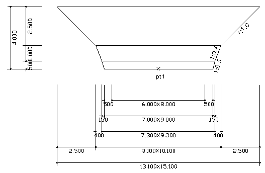
Draw an figure when you calculate the amount of excavation. It draw only a figure. Please refer to the following for various default values ??and usage.
◆ Notice 사항 및 default ▷ It is suitable only original ground surface is level. ▷ Slop of soil is 1:1, weathered rock 1:0.4, soft rock 1:0.3 ▷ distance between slop to structure is 0.5m ▷ This program draw figure two case that excavation depth is over 4m and under 4m
 Example
Insert (MID)point:{p1} [Pick center point of footing]
B(m): 6
Example
Insert (MID)point:{p1} [Pick center point of footing]
B(m): 6